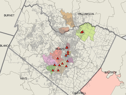
| I first started with a base map of Travis and the surrounding counties. I then added a layer for the streets. I compiled a list of competitor stores in Excel and then geocoded the excel worksheet with the Austin area streets layer within ArcView. This provides the reader with information on where the stores are located in relation to the streets within the Austin area and the county. The colored areas are the zipcodes that the competitor stores reside in. I only plotted the ones that were actually within Travis County. There were also a few stores that did not have adquete addresses or an address at all. Those did not get plotted, but the zip code they reside in was still highlighted. This way the reader knows that there is a store located in that zip code. | |
| STORE_NAME | STREET_ADD | CITY | STATE | ZIP |
| 5jo Creations | 148 Oak Ridge Drive | Austin | TX | 78612 |
| A Flower Basket | 1901 West William Cannon | Austin | TX | 78745 |
| A New Leaf Florist | 7323 Burnet Road | Austin | TX | 78757 |
| Ali Bleu Flowers & Gifts | 6800 Westgate Boulevard | Austin | TX | 78745 |
| Always and Forever Florist | 7010 Burnet Road | Austin | TX | 78757 |
| Austin Gift Company | 4211 South Lamar | Austin | TX | 78704 |
| Big Red Sun | 1102 East Cesar Chavez | Austin | TX | 78702 |
| Blue Moon Glassworks | 5241 North Lamar | Austin | TX | 78751 |
| Bonnie Mann Design | 2311 Thornton Road | Austin | TX | 78704 |
| Breed & Co. | 718 West 29th Street | Austin | TX | 78705 |
| Breed & Co. | 3663 Bee Caves Road | Austin | TX | 78746 |
| Celebration | 108 West 43rd Street | Austin | TX | 78751 |
| Garden Ridge Pottery | 2800 South Interstate 3 | Austin | TX | 78681 |
| Garden Ridge Pottery | 5151 West Highway 290 | Austin | TX | 78735 |
| Green 'N Growing | 601 West Pecan Street | Austin | TX | 78660 |
| Mandolin Design | 3805 Arrow Drive | Austin | TX | 78749 |
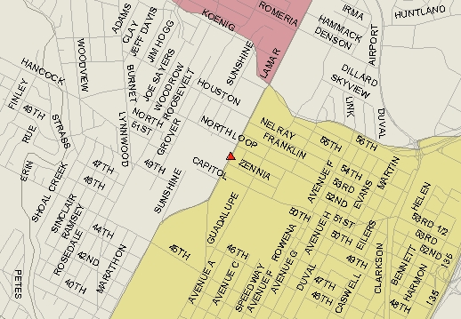
ArcView allows you to zoom in down to the street level and can even show which side of the street the store is on. When the information button is active then you can point on any store and find the name and address of that store.
The next step was to show the zoning of these areas and find a possible location for the business. I downloaded zoning information from the City of Austin.
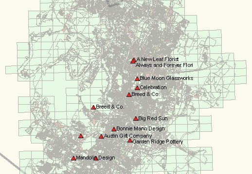 |
I kept the competitor store layer activated and the commercial zoning lots are in pink. |
 |
Here is a closer view. |
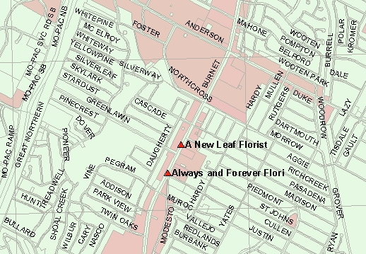 |
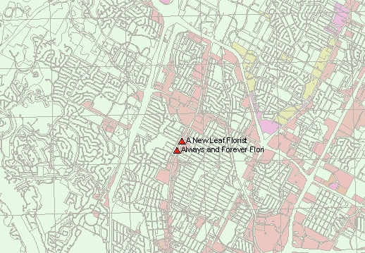
An even closer view with the streets now labeled. |
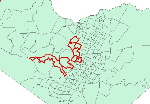
I then downloaded housing cost and percent owner occupied housing information from the U.S. Census Bureau. I created a query to select only those census tracts with over 1000 units that are occupied by the owner and with over 100 of those households that have a value of $200,000 - 300,000.
A comparison can be made between these two Census Tract Map and Zip Code Maps.
 |
|